Carried Away: The Atmospheric Science of Pesticide Drift and Why Buffer Zones Are Falling Short
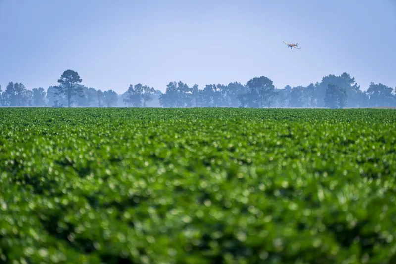
On a still morning in California's San Joaquin Valley, a spray rig moves methodically through an almond orchard. The application looks controlled—nozzles calibrated, wind speeds logged, buffer distances observed. Yet within hours, trace concentrations of the applied fungicide may be detectable in a creek bed two miles away, on the windowsills of a farmworker housing complex, or in the bodies of monarch butterflies resting in a nearby hedgerow. This is the drift problem, and it is considerably more complex than the regulatory frameworks built to contain it.
Pesticide drift encompasses two distinct but related phenomena: particle drift, in which spray droplets are carried off-target by wind currents during or immediately after application, and vapor drift, in which semi-volatile compounds volatilize from treated surfaces hours or even days later and migrate through the atmosphere. Both pathways deposit chemical residues in unintended locations. The difference is that particle drift is at least visible in principle—measurable at the moment of application—while vapor drift is largely invisible, delayed, and far more difficult to attribute to any single source.
The Physics of an Unintended Journey
Droplet behavior in air is governed by a well-understood set of physical principles, though applying those principles to real-world agricultural settings is anything but straightforward. Small droplets—those below roughly 150 microns in diameter—are particularly susceptible to wind transport because their settling velocity is low relative to ambient air movement. Many modern spray formulations are deliberately designed to produce fine droplets for canopy penetration and coverage, which inadvertently optimizes them for off-target movement.
Atmospheric stability conditions compound the problem. Temperature inversions, which are common in agricultural regions during early morning application windows, trap pesticide-laden air masses near the surface and can transport them laterally over surprisingly long distances before dispersal occurs. Research published in atmospheric science journals has documented chlorpyrifos and trifluralin detections at monitoring stations situated well outside any plausible application zone, with isotopic and temporal fingerprinting suggesting transport distances exceeding ten miles under inversion conditions.
Volatilization adds a separate dimension. Compounds like triallate, DCPA, and several pyrethroids have vapor pressures and Henry's Law constants that make post-application volatilization a significant exposure pathway. A field treated on Monday may continue releasing detectable atmospheric concentrations through Wednesday, long after any spray event has concluded and long after any regulatory buffer zone requirement would have applied.
What Monitoring Data Reveals—and Conceals
The United States lacks a comprehensive, nationally coordinated pesticide air monitoring program. The EPA's ambient air monitoring infrastructure was built primarily around criteria pollutants under the Clean Air Act, and pesticides occupy an awkward regulatory gap: they are regulated as agricultural inputs under FIFRA, but their atmospheric transport places them in an environmental medium that FIFRA was not designed to govern.
California's Department of Pesticide Regulation operates the most extensive state-level air monitoring network in the country, and its data are instructive. Monitoring stations in agricultural counties have detected dozens of pesticide compounds in ambient air, frequently at concentrations exceeding health-protective benchmarks developed for chronic inhalation exposure. Chlorpyrifos, before its agricultural use was phased out in California, was detected at virtually every monitoring station in the Central Valley during application seasons. The implication is not merely that drift occurs, but that it occurs systematically and at scale.
At the federal level, the EPA has acknowledged data gaps in pesticide air monitoring but has not moved to fill them with a structured national program. The result is that risk assessments for most registered pesticides do not incorporate realistic atmospheric transport scenarios. Bystander exposure estimates in registration documents typically assume limited, localized drift and do not account for the cumulative burden of living in a region where dozens of compounds are simultaneously present in ambient air throughout the growing season.
Buffer Zones: A Regulatory Tool With Known Limits
Buffer zone requirements are the primary regulatory mechanism for managing spray drift at the point of application. These mandatory setback distances between application sites and sensitive areas—schools, residences, water bodies—are calculated using drift exposure models developed by the EPA, principally the AgDRIFT model and its derivatives. These models estimate droplet deposition as a function of wind speed, nozzle type, boom height, and other application parameters.
The scientific critique of these models centers on their underlying assumptions. AgDRIFT was developed and validated primarily using data from controlled field trials conducted under relatively benign meteorological conditions. Real-world applications occur under a far wider range of atmospheric conditions, including the temperature inversions and low-level jets that dramatically extend transport distances. The models also do not incorporate vapor drift, treating volatilization as a separate and largely unregulated phenomenon.
Independent researchers have compared model predictions against empirical measurements from drift incidents and found consistent underestimation of off-target deposition, particularly at distances beyond a few hundred meters. A systematic review of drift measurement studies found that real-world deposition at 500 meters from an application site was frequently an order of magnitude higher than model predictions under comparable nominal conditions. If buffer zone distances are calibrated to model outputs that underestimate actual drift, the protection they afford is correspondingly less than assumed.
Emerging Detection Technologies and What They're Finding
Advances in atmospheric sampling and analytical chemistry are beginning to close the observational gap that has allowed drift to remain undercharacterized. Passive air samplers—low-cost, deployable devices that accumulate ambient compounds over days or weeks—have enabled community-based monitoring programs to document pesticide presence in residential neighborhoods adjacent to agricultural land. Organizations working with farmworker communities in states including Florida, Washington, and North Carolina have used these samplers to generate datasets that challenge the adequacy of current buffer zones.
High-resolution mass spectrometry, combined with improved sample preparation techniques, has lowered detection limits for dozens of pesticide compounds to the parts-per-trillion range in air matrices. This sensitivity makes it possible to detect trace-level exposures that would have been analytically invisible a decade ago, and to distinguish among compounds with similar molecular weights that older analytical methods could not resolve.
Drone-based atmospheric profiling represents another frontier. Small unmanned aircraft equipped with sampling modules can characterize the three-dimensional distribution of pesticide concentrations in the air column above and downwind of application sites, providing spatial resolution that ground-based networks cannot match. Early deployments of this technology in research settings have confirmed that vertical mixing carries pesticide-laden air masses to altitudes where regional transport becomes feasible.
A Path Toward More Protective Policy
The scientific evidence increasingly supports the argument that current regulatory frameworks are not calibrated to the actual behavior of pesticides in the atmosphere. Closing that gap will require action on several fronts simultaneously.
A national pesticide air monitoring program, modeled on California's existing infrastructure but scaled to represent the diversity of agricultural regions and application practices across the country, would provide the empirical foundation that risk assessments currently lack. Without systematic monitoring data, it is impossible to know whether buffer zone requirements are protective or merely nominal.
Drift modeling tools used in registration decisions should be updated to incorporate vapor transport pathways and validated against empirical measurements from real-world application conditions, including adverse meteorological scenarios. Regulatory reliance on models that systematically underestimate exposure introduces a structural bias toward underprotection.
Finally, the cumulative dimension of drift exposure deserves explicit regulatory attention. Individual pesticide registrations are evaluated in isolation, but communities near agricultural land are exposed to complex, seasonally variable mixtures of airborne compounds. The drift problem, at its core, is not only a question of where a given pesticide goes after application—it is a question of what the air in America's agricultural regions actually contains, and whether the people who live and work there are being adequately protected by the rules that govern it.